


Description
Gold Basin Footprints DVD – $79.95
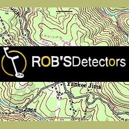
The Gold Basin FootPrint maps almost 200 square miles, covering the Gold Basin and Lost Basin mining districts in northwestern Arizona.
This area is perfect for a week long prospecting trip. It’s less than a two hour drive across the Colorado River from Las Vegas, NV. Day trips to Lake Mead or the Franconia strewn field to look for meteorites are well worth the time.
The placers in this area were not heavily worked until the 1930’s and they have only been worked on a small scale ever since. The area is relatively remote with the small towns of Meadview and Dolan Springs being the closest settlements.
FootPrint Details
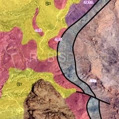
The Gold Basin FootPrint provides an incredible amount of information that you will not find mapped anywhere else.
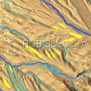
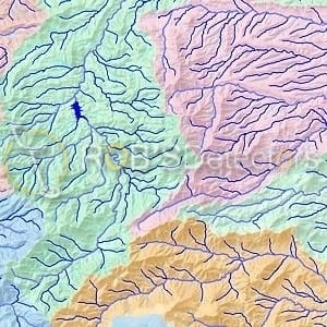
In addition to the Standard map layers, we provide custom layers on Mining Claims, Water Flow, Geology, Historical placer workings and even old drywashing sites that can practically tell you where the gold is to be found.
We have mapped the Geology of these productive placer areas at 1:48,000 clearly identifying the following;
Gold Bearing Quaternary Gravels
Historical Placer Workings
Over 100 pits, adits, old drywasher sites and placers with detailed descriptions.
We digitize USGS reports and customize the data specifically for the prospector. We include all source documents in PDF format in the FootPrint for additional reasearch. In this FootPrint we include the following detailed reports;
USGS Professional Paper 1361, Geologic Map and Report of the Gold Basin & Lost Basin Mining Districts
USGS Open File Report 75-93 – Geologic Map
USGS Bulletin 397 – Geologic Report
Additional information
| MPN | FP-GB |
|---|---|
| Brand | Footprints |
You must be logged in to post a review.
Reviews
There are no reviews yet.